It is well known that the energy crisis has sparked an unprecedented interest in all forms of renewable energy, including wind. Correspondingly, Dulas has experienced an increased demand for its remote sensing LiDAR systems in 2022, with orders for rental units and purchases dramatically upturning in the second half of the year. The hunt for reliable sources of renewable domestic energy has naturally led to an increase in wind measurement campaigns but this has become only more urgent since the war in Ukraine, which has led to the current energy crisis. Traditionally, meteorological masts have been used to gather wind data, but remote sensing LiDAR systems are now often deployed alongside masts and offer a number of advantages to developers that seek to kick-start any campaigns.
Quicker, cheaper and safer to deploy
Cost pressures on wind farm development in mature markets now mean that data collection and analysis in the development stage of wind projects needs to be efficient, easy and expedient. Taller and taller turbine designs have a corresponding effect on meteorological masts, which also have to increase in height to reach the required measurement standards. This impacts both the cost of the installation and, more importantly, the safety considerations associated with working at height.
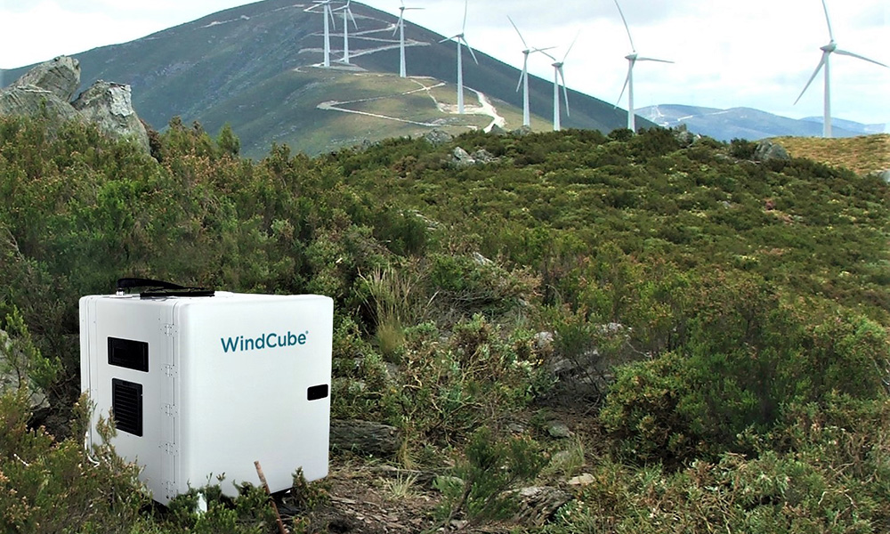
Remote sensing LiDAR equipment, such as the WindCube V2.1 from Vaisala, can often be deployed without planning permission, which significantly reduces the timescale of mobilisation. LiDARs are easier to transport and install, particularly at less accessible onshore or offshore sites, and the ground work required is limited, further reducing costs. Crucially, they also remove the need to work at height, increasing worker safety.
Advanced technology
Advances in remote sensing technology have made LiDAR more reliable and accurate over the years, and where once met masts were the only viable option to collect data, LiDAR data is now increasingly being adopted. For example, the Vaisala WindCube, one of the world’s leading vertical wind profilers, is capable of measuring at 20 heights simultaneously, and is accurate across a range of heights up to 300m. The data it produces meets all international standards and guidelines, where terrain features are suitable. Whether used onshore or offshore, it can be redeployed at all four stages of project development and operations – prospecting, assessment, monitoring, and optimisation – making it exceptional value for money.
Reliable in complex terrain
In recent years, the WindCube has been developed to improve its performance in complex terrain, which is very common in the UK. WindCube uses Flow Complexity Recognition (FCR) technology – an automatic online correction system which takes into account complex terrain. The result is better, bankable data and a more complete view of the wind profile, both of which help to secure funding and reduce financial uncertainty.
“Our Wind Monitoring team is very busy indeed and we are responding not only to our existing customers’ needs but are also glad to be working with new entrants to the market. Wind is going to play a crucial role in delivering net zero in the UK and more sites, both onshore and offshore, will be needed to get us there. WindCube technology can help get these projects out of the starting blocks quickly and cost effectively.”
Dulas offers end to end deployment services for WindCube and other remote sensing devices depending on client preference. These include a range of bespoke remote power systems that are customised to each deployment location, and integrated telecoms, fuel systems and data loggers.


